
Article Sidebar
Main Article Content
Abstract
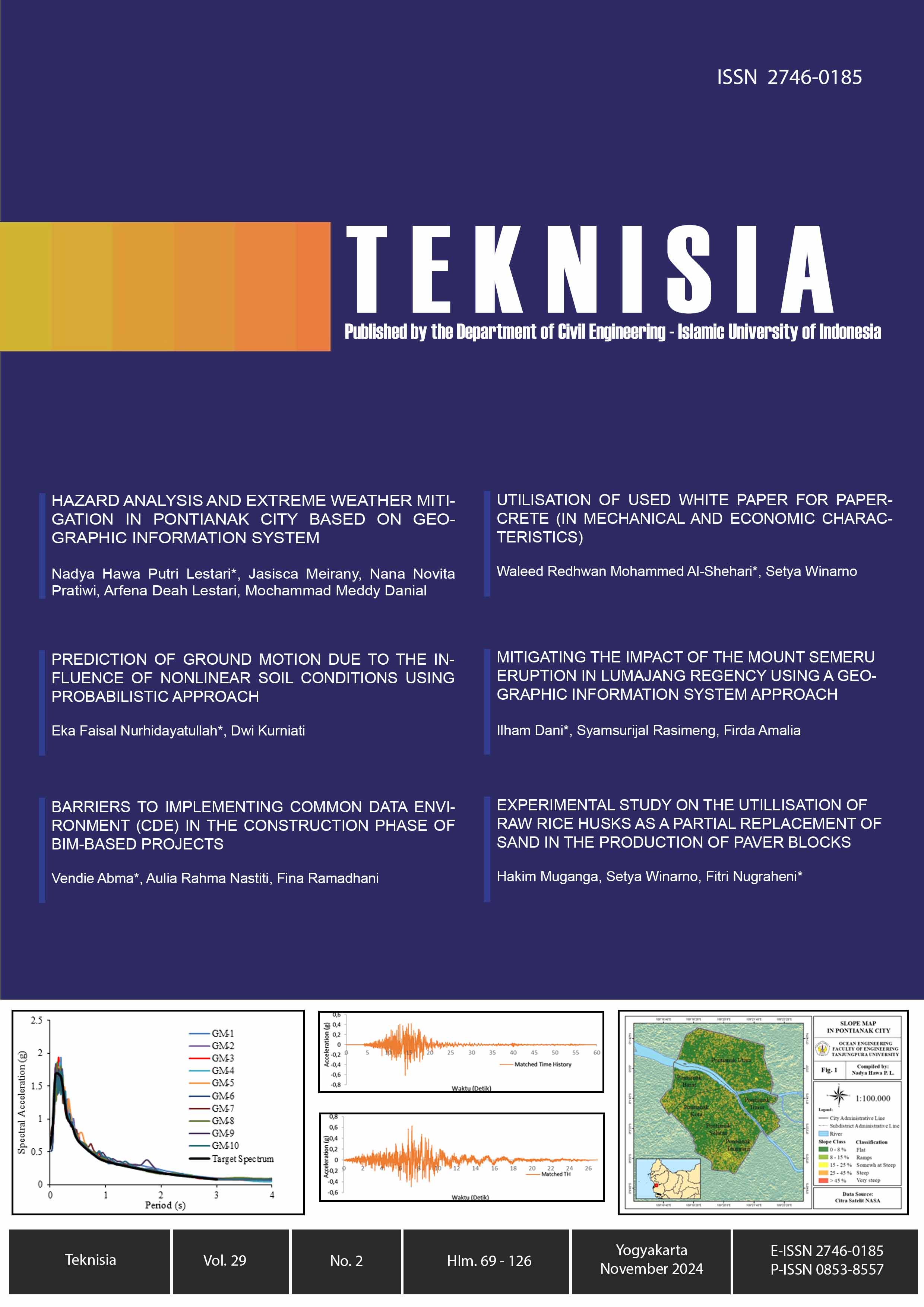
The geographical location of Pontianak City, situated on the Equator, creates a high potential for hydrometeorological disasters, particularly extreme weather events such as whirlwinds. Based on the history of recurring events, it is essential to conduct this research to recommend disaster mitigation strategies based on hazard analysis and the Extreme Weather Disaster Class Index in Pontianak City. The data used are slope, land use, annual rainfall, and surface air temperature. These parameters are processed using the ArcGIS software. The results of the hazard analysis indicate that Pontianak City has a moderate level of hazard, covering an area of 5,191.46 ha, or 44.41% of the total area of Pontianak City. Sub-districts with medium-level potential areas are Pontianak Kota sub-district, with an area of 883.56 ha, West Pontianak sub-district, with an area of 836.97 ha, and South Pontianak sub-district, with an area of 761.59 ha. The non-structural disaster mitigation measures that need to be implemented to reduce the impact of extreme weather disasters include disaster risk assessment, enforcement of mitigation-based spatial plans, and community engagement. While structural mitigation can be achieved by strengthening building structures, these structures must utilize materials and construction techniques that are resistant to whirlwinds and enhance the strength of foundations, walls, and roofs. Making evacuation routes based on disaster mitigation and installing early warning equipment, such as Weather Information Display (WID), also needs to be done in an effort to minimize the impact of extreme whirlwind weather.
Keywords
Article Details
Copyright (c) 2025 Nadya Hawa Putri Lestari

This work is licensed under a Creative Commons Attribution-ShareAlike 4.0 International License.
Under the following term:
-
Attribution — You must give appropriate credit, provide a link to the license, and indicate if changes were made. You may do so in any reasonable manner, but not in any way that suggests the licensor endorses you or your use.
-
ShareAlike — If you remix, transform, or build upon the material, you must distribute your contributions under the same license as the original.
- No additional restrictions — You may not apply legal terms or technological measures that legally restrict others from doing anything the license permits.
References
- Destiana, M. (2023). Mapping of Tornado Hazard Levels Based on Geographic Information System and Remote Sensing in East Bandung Regency (Pemetaan Tingkat Bahaya Angin Puting Beliung Berbasis Sistem Informasi Geografis Dan Penginderaan Jauh Di Kabupaten Bandung Bagian Timur). Universitas Pendidikan Indonesia.
- Guswanto. (2024). Extreme Weather Phenomenon of Tornado Occurs in West Java Region (Fenomena Cuaca Ekstrem Puting Beliung Terjadi di Wilayah Jawa Barat). BMKG. https://www.bmkg.go.id/siaran-pers/bmkg-fenomena-cuaca-ekstrem-puting-beliung-terjadi-di-wilayah-jawa-barat-apa-dan-bagaimana-potensi-ke-depannya
- Handoko, D., Nugraha, A. L., & Prasetyo, Y. (2017). Study on Vulnerability Mapping of Semarang City to Multiple Disasters Based on Remote Sensing and Geographic Information Systems (Kajian Pemetaan Kerentanan Kota Semarang Terhadap Multi Bencana Berbasis Pengindraan Jauh Dan Sistem Informasi Geografis). Journal of Geodesy UNDIP, 6(3), 1–10. https://doi.org/https://doi.org/10.14710/jgundip.2017.17173
- Head Regulation Of BMKG No. 09/2010: Standard Operating Procedures For Early Warning, Reporting, And Dissemination Of Extreme Weather Information, 1 (2010).
- Head Regulation of BNPB No. 02/2012: General Guidelines for Disaster Risk Assessment (2012).
- Hidayat, R., & Farihah, A. W. (2020). Identification of the changing air temperature and rainfall in Bogor (Identifikasi perubahan suhu udara dan curah hujan di Bogor). Journal of Natural Resources and Environmental Management, 10(4), 616–626. https://doi.org/10.29244/jpsl.10.4.616-626
- Kurniawati, D. (2018). Communication on Disaster Mitigation as Community Precautions in Disaster Management. Journal of SIMBOLIKA: Research and Learning in Communication Study, 6(1), 51–58. https://doi.org/https://doi.org/10.31289/simbollika.v6i1.3494
- Luthfiarta, A., Febriyanto, A., Lestiawan, H., & Wicaksono, W. (2020). Weather Forecast Analysis with Temperature, Humidity, Air Pressure, and Wind Speed Parameters Using Multiple Linear Regression (Analisa Prakiraan Cuaca dengan Parameter Suhu, Kelembaban, Tekanan Udara, dan Kecepatan Angin Menggunakan Regresi Linear Bergan. JOINS (Journal of Information System), 5(1), 10–17. https://doi.org/https://doi.org/10.33633/joins.v5i1.2760
- Maulana, A. T., & Andriansyah. (2024). Disaster Mitigation in Indonesia (Mitigasi Bencana di Indonesia). Journal of Research and Community Service, 3(10), 3996–4012. https://doi.org/https://doi.org/10.59141/comserva.v3i10.1213
- Meiwandari, M., Iskandar, I., & Irfan, M. (2024). Trend Analysis of Extreme Rainfall and Temperature in Jambi Province Using Mann-Kendall and Sen’s Slope (Analisis Tren Curah Hujan Dan Suhu Ekstrem Di Provinsi Jambi Menggunakan Mann-Kendall Dan Sen’s Slope). Journal of Innovation and Physics, 11(1), 14–27.
- Mukhlisinpa, M. N., & Gucci, U. K. (2023). Analysis of Potential and Mitigation of First-Priority Disasters Associated with Gunungkidul Regency Government Policies (Analisa Potensi dan Mitigasi Bencana Prioritas Pertama yang Dikaitkan dengan Kebijakan Pemerintah Kabupaten Gunungkidul dalam Menangg. Science And Engineering National Seminar, 8, 70–79.
- Nurlambang, T., Kusratmoko, E., Ludiro, D., Harmantyo, D., Halide, H., Sobirin, Rahmawati, F., Rahatiningtyas, N., Rustanto, A., Zakir, A., Yunus, R., Estrely, M., Nurraini, Y., Indratmoko, S., & Anggraeni, D. (2013). Extreme Weather Disaster Management in Indonesia (Penanggulan Bencana Cuaca Ekstrim Di Indonesia). Proceedings of the National Disaster Research Seminar.
- Prabowo, R. W. (2020). Typology of Building Damage due to Extreme Weather Case Study of Extreme Weather in Bantul District 2019 (Tipologi Kerusakan Bangunan Akibat Cuaca Ekstrem Studi Kasus Cuaca Ekstrem Kabupaten Bantul 2019). Journal of Urban and Regional Planning, 2(2), 31–38. https://doi.org/https://doi.org/10.32795/space.v2i2.1123
- Pratama, F. Y., Meirany, J., & Wulandari, A. (2023). Multi Disaster Risk Mapping in Sungai Raya Kepulauan Sub-district, Bengkayang Regency (Pemetaan Multi Resiko Bencana Di Kecamatan Sungai Raya Kepulauan Kabupaten Bengkayang). JeLAST (Journal of Ocean Engineering, Urban and Regional Planning, Civil, and Mining), 10(1). https://doi.org/https://doi.org/10.26418/jelast.v10i1.62419
- Putra, M. H. P., & Karomah, A. (2022). Implementationof a Geographic Information System (GIS) for Flood Vulnerability Mapping in Kebumen Regional. Journal of Science and Technology, 1(1).
- Putri, S. B., Meirany, J., Pratiwi, N. N., Lestari, A. D., & Danial, M. M. (2023). Mapping of Disaster-Prone Areas in Gis-Based Disaster Mitigation Efforts in Sungai Raya Kepulauan District, Bengkayang Regency, West Kalimantan Province. Journal of Ocean Science and Technology Innovation, 4(2), 171–181. https://doi.org/https://doi.org/10.62012/zl.v4i2.27374
- Rahmaniar, J., Arsyad, M., & Tiwow, V. A. (2020). The Influence of Madden Julian Oscillation (MJO) on Sea Wave Height in the Makassar Strait (Pengaruh Madden Julian Oscillation (MJO) terhadap Tinggi Gelombang Laut di Selat Makassar). National Physics Seminar, 52–55.
- Safitri, S. (2015). El Nino, La Nina and The Effect to Existance in Indonesia (El Nino, La Nina Dan Dampaknya Terhadap Kehidupan Di Indonesia). Criksetra Journal, 4(8).
- Sumantri, S. H., Supriyatno, M., Sutisna, S., Surv, M., & Widana, I. D. K. K. (2019). Geographic Information System Disaster Vulnerability (1st ed.; S. Inaka, Ed.) (Sistem Informasi Geografi Kerentanan Bencana). CV. Makmur Cahaya Ilmu. https://scholar.google.co.id/citations?view_op=view_citation&hl=id&user=3urTp_kAAAAJ&citation_for_view=3urTp_kAAAAJ:_kc_bZDykSQC
- Widodo, S., & Manaf, M. (2021). Zoning Level of Extreme Weather Distribution in Sorong Regency Based on Geographic Information System (Zonasi Tingkat Persebaran Cuaca Ekstrem Kabupaten Sorong Berbasis Geographic Information System). Journal of Ecosystem Science, 21(2), 229–235. https://doi.org/DOI:10.35965/eco.v21i2.1074
- Wijaya, O., Rifai, M., & Wardhani, Y. (2018). Disaster Management and Disaster Resilient Village (Manajemen Bencana dan Desa Tangguh Bencana). CV Mine.
References
Destiana, M. (2023). Mapping of Tornado Hazard Levels Based on Geographic Information System and Remote Sensing in East Bandung Regency (Pemetaan Tingkat Bahaya Angin Puting Beliung Berbasis Sistem Informasi Geografis Dan Penginderaan Jauh Di Kabupaten Bandung Bagian Timur). Universitas Pendidikan Indonesia.
Guswanto. (2024). Extreme Weather Phenomenon of Tornado Occurs in West Java Region (Fenomena Cuaca Ekstrem Puting Beliung Terjadi di Wilayah Jawa Barat). BMKG. https://www.bmkg.go.id/siaran-pers/bmkg-fenomena-cuaca-ekstrem-puting-beliung-terjadi-di-wilayah-jawa-barat-apa-dan-bagaimana-potensi-ke-depannya
Handoko, D., Nugraha, A. L., & Prasetyo, Y. (2017). Study on Vulnerability Mapping of Semarang City to Multiple Disasters Based on Remote Sensing and Geographic Information Systems (Kajian Pemetaan Kerentanan Kota Semarang Terhadap Multi Bencana Berbasis Pengindraan Jauh Dan Sistem Informasi Geografis). Journal of Geodesy UNDIP, 6(3), 1–10. https://doi.org/https://doi.org/10.14710/jgundip.2017.17173
Head Regulation Of BMKG No. 09/2010: Standard Operating Procedures For Early Warning, Reporting, And Dissemination Of Extreme Weather Information, 1 (2010).
Head Regulation of BNPB No. 02/2012: General Guidelines for Disaster Risk Assessment (2012).
Hidayat, R., & Farihah, A. W. (2020). Identification of the changing air temperature and rainfall in Bogor (Identifikasi perubahan suhu udara dan curah hujan di Bogor). Journal of Natural Resources and Environmental Management, 10(4), 616–626. https://doi.org/10.29244/jpsl.10.4.616-626
Kurniawati, D. (2018). Communication on Disaster Mitigation as Community Precautions in Disaster Management. Journal of SIMBOLIKA: Research and Learning in Communication Study, 6(1), 51–58. https://doi.org/https://doi.org/10.31289/simbollika.v6i1.3494
Luthfiarta, A., Febriyanto, A., Lestiawan, H., & Wicaksono, W. (2020). Weather Forecast Analysis with Temperature, Humidity, Air Pressure, and Wind Speed Parameters Using Multiple Linear Regression (Analisa Prakiraan Cuaca dengan Parameter Suhu, Kelembaban, Tekanan Udara, dan Kecepatan Angin Menggunakan Regresi Linear Bergan. JOINS (Journal of Information System), 5(1), 10–17. https://doi.org/https://doi.org/10.33633/joins.v5i1.2760
Maulana, A. T., & Andriansyah. (2024). Disaster Mitigation in Indonesia (Mitigasi Bencana di Indonesia). Journal of Research and Community Service, 3(10), 3996–4012. https://doi.org/https://doi.org/10.59141/comserva.v3i10.1213
Meiwandari, M., Iskandar, I., & Irfan, M. (2024). Trend Analysis of Extreme Rainfall and Temperature in Jambi Province Using Mann-Kendall and Sen’s Slope (Analisis Tren Curah Hujan Dan Suhu Ekstrem Di Provinsi Jambi Menggunakan Mann-Kendall Dan Sen’s Slope). Journal of Innovation and Physics, 11(1), 14–27.
Mukhlisinpa, M. N., & Gucci, U. K. (2023). Analysis of Potential and Mitigation of First-Priority Disasters Associated with Gunungkidul Regency Government Policies (Analisa Potensi dan Mitigasi Bencana Prioritas Pertama yang Dikaitkan dengan Kebijakan Pemerintah Kabupaten Gunungkidul dalam Menangg. Science And Engineering National Seminar, 8, 70–79.
Nurlambang, T., Kusratmoko, E., Ludiro, D., Harmantyo, D., Halide, H., Sobirin, Rahmawati, F., Rahatiningtyas, N., Rustanto, A., Zakir, A., Yunus, R., Estrely, M., Nurraini, Y., Indratmoko, S., & Anggraeni, D. (2013). Extreme Weather Disaster Management in Indonesia (Penanggulan Bencana Cuaca Ekstrim Di Indonesia). Proceedings of the National Disaster Research Seminar.
Prabowo, R. W. (2020). Typology of Building Damage due to Extreme Weather Case Study of Extreme Weather in Bantul District 2019 (Tipologi Kerusakan Bangunan Akibat Cuaca Ekstrem Studi Kasus Cuaca Ekstrem Kabupaten Bantul 2019). Journal of Urban and Regional Planning, 2(2), 31–38. https://doi.org/https://doi.org/10.32795/space.v2i2.1123
Pratama, F. Y., Meirany, J., & Wulandari, A. (2023). Multi Disaster Risk Mapping in Sungai Raya Kepulauan Sub-district, Bengkayang Regency (Pemetaan Multi Resiko Bencana Di Kecamatan Sungai Raya Kepulauan Kabupaten Bengkayang). JeLAST (Journal of Ocean Engineering, Urban and Regional Planning, Civil, and Mining), 10(1). https://doi.org/https://doi.org/10.26418/jelast.v10i1.62419
Putra, M. H. P., & Karomah, A. (2022). Implementationof a Geographic Information System (GIS) for Flood Vulnerability Mapping in Kebumen Regional. Journal of Science and Technology, 1(1).
Putri, S. B., Meirany, J., Pratiwi, N. N., Lestari, A. D., & Danial, M. M. (2023). Mapping of Disaster-Prone Areas in Gis-Based Disaster Mitigation Efforts in Sungai Raya Kepulauan District, Bengkayang Regency, West Kalimantan Province. Journal of Ocean Science and Technology Innovation, 4(2), 171–181. https://doi.org/https://doi.org/10.62012/zl.v4i2.27374
Rahmaniar, J., Arsyad, M., & Tiwow, V. A. (2020). The Influence of Madden Julian Oscillation (MJO) on Sea Wave Height in the Makassar Strait (Pengaruh Madden Julian Oscillation (MJO) terhadap Tinggi Gelombang Laut di Selat Makassar). National Physics Seminar, 52–55.
Safitri, S. (2015). El Nino, La Nina and The Effect to Existance in Indonesia (El Nino, La Nina Dan Dampaknya Terhadap Kehidupan Di Indonesia). Criksetra Journal, 4(8).
Sumantri, S. H., Supriyatno, M., Sutisna, S., Surv, M., & Widana, I. D. K. K. (2019). Geographic Information System Disaster Vulnerability (1st ed.; S. Inaka, Ed.) (Sistem Informasi Geografi Kerentanan Bencana). CV. Makmur Cahaya Ilmu. https://scholar.google.co.id/citations?view_op=view_citation&hl=id&user=3urTp_kAAAAJ&citation_for_view=3urTp_kAAAAJ:_kc_bZDykSQC
Widodo, S., & Manaf, M. (2021). Zoning Level of Extreme Weather Distribution in Sorong Regency Based on Geographic Information System (Zonasi Tingkat Persebaran Cuaca Ekstrem Kabupaten Sorong Berbasis Geographic Information System). Journal of Ecosystem Science, 21(2), 229–235. https://doi.org/DOI:10.35965/eco.v21i2.1074
Wijaya, O., Rifai, M., & Wardhani, Y. (2018). Disaster Management and Disaster Resilient Village (Manajemen Bencana dan Desa Tangguh Bencana). CV Mine.